Lake Tahoe mountain biking, June 1998
On June 20th, 1998—the last day of spring—I left the Tamarack Lodge in search of some Tahoe area back roads. I had never been to Tahoe before, and it had been some time since I’d done any serious off-road riding, so I was looking for something that would be fun without being too challenging (insert sardonic “Hah!”). I started out on Highway 28 headed north, looking for a dirt road that would take me up near Watson Lake and eventually out to Highway 267.
Unfortunately, I didn’t have a great map, and the dirt roads are not well-marked, so I wound up staying on 28 longer than I expected. I did get some great views of Lake Tahoe from the side of the road overlooking Carnelian Bay; it was sort of a hazy morning, but you can see that there’s still snow on the mountains from the ridiculous weather we had this winter and spring—the weekend I was up there was really the first warm one Tahoe had seen.

Tahoe itself is a deep, clear blue, but where it’s shallower, such as Agate Bay it often picks up the greens of the surrounding mountains.

I finally turned off 28 on National Ave. in Tahoe Vista, and got my first off-road riding on a narrow, rocky road, where I had one of those embarrassing 0-mph sideways falls when I lost traction on a climb. It clearly had been too long since I was off-road. I continued on and eventually met up with Highway 267.
Highway 267 goes over Brockway Summit, near NorthStar at Tahoe for you skiing buffs. It’s a fairly steep, constant grade, with some nice views of the surrounding mountains and the lake. I was expecting to have some problems with the altitude, but I didn’t really notice any shortness of breath, and I made the summit (7179 feet–almost twice Diablo’s altitude) still feeling good.

High speeds on bicycles are generally limited by wind resistance; power to overcome wind resistance increases cubically with airspeed, while most other power equations are squared, linear or constant. The bicycle land speed record is just over 166 MPH, set by riding behind an odd contraption that looked like a top fuel dragster with a garden shed strapped to its back.
The upshot of this is, when you’re at high altitude, you go a lot faster on downhills. I had neglected to bring my bike computer, but I can attest that the downhill on the other side of Brockway Summit is the fastest my MB-3 has ever gone. It almost made me wish I’d brought my fast road bike so I could spin out the 53×12 to get going; the MB-3’s top gear is something wimpy like 46×13. On the way down I saw alpine meadows damp from melting snow.
Highway 267 descends into the Martis Valley, which was at the time flush with water from the late snowmelt. feeding vernal ponds, I would guess normally dry by summer, but in 1998, just getting started.

I rolled into Truckee, which struck me as a rather dirty and unimpressive town. I picked up a somewhat better map at a 7-11, because I was still having problems finding the dirt road I wanted to use for the return trip. I eventually located it and began heading back south to Tahoe City.
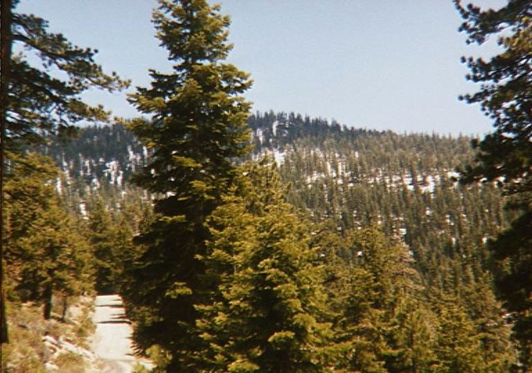
The road is called Forest Service 06, and is used as a fire and logging road in the summer, and a snowmobile trail in the winter. There was a distressing amount of obvious recent logging activity, but nothing actively going on while I was up there. There was very little traffic; I ran into a few cyclists, a couple joggers, and 2 or 3 cars. The area was pretty, and had some great views as I started to climb. Picture 8 was taken after the road began to climb, and before I started to hit snow.
Snow, yes, on the last day of spring. There must have been simply an insane amount of snow on these mountains back in Feburary, because here in late June there was still 2-3 feet of snow on the road in places, and a lot more under the trees and on the peaks. Basically anywhere that didn’t get a lot of sun had a lot of snow. I first started encountering the white stuff at around 7000 feet.
I started to get kind of worried at this point. I was at about 7000 feet, and the route I was planning to take would take me above 7800 feet, where, presumably, there would be even more snow. But since my only other option was to turn back to Truckee and take Highway 89, I decided to keep going.
Soon I started to run into snow on the road. It would come in strange batches, obviously loosely related to the altitude and shade on the road, but not consistently so. The picture is actually of the first really serious patches I ran into, but it got much worse than that. However, when it got worse, I was not in the mood to be taking snapshots.
I had another silly 0-mph ditch trying to ride over one of the snowdrifts. After that I found out that I could just blow through the narrow ones; trying to go through slowly was asking to get stuck and dumped. In any case, it wasn’t long before the snow became too prevalent and continuous to ride over very much; there were patches of road instead of patches of snow. It got extremely tiring pushing my bike through these 2-3 foot drifts of snow. I was encouraged, though, that there appeared to be one set of bike tracks from someone who had been through before me (possibly the same day). If he’d had to turn back, there would be two sets of tracks, was my logic. So, still I pressed on.
It was a little hard to navigate because the trails were poorly marked and the streams on my map were joined by dozens of temporary streams from melting snow, many of which had significant flows on this extremely warm day. But near as I can tell, I could see Mount Pluto (8617′) ahead, and the road at that point is around 7500′.
Those temporary streams also changed the cleanliness level of the ride. Up until now it had been fairly clean, with no water or mud on the roads and trails, but when I started getting into snowmelt areas, the road itself became very muddy, and there were a few fairly deep streams cutting across the road. Mud was soon flying everywhere; it became hard to drink from my water bottles because they were caked with the stuff.
After that point, the ride started to get difficult. The road turned so it was on the north-facing side of Mount Watson, so there was much more snow to deal with. It also continued to climb, peaking near 7900′. Above 7500′, I started to feel the effects of the altitude and the additional work of pushing the bike over snowbanks–every time I had to get off and push, my heart rate would jump way up and I’d have to rest before continuing. At one point I was considering turning back when I saw a good 30 or 40 meters of uninterrupted snow in front of me, but there was still that one set of bike tracks ahead, so I leaned my bike against a tree and walked up the road to see if there was going to be any significant change, and to my great relief there was a junction that I could easily identify on my map, and the promise of the road descending. So I walked back to the bike, slogged over the snow, and started the trip down to Tahoe City.
There was still a lot of snow on the downslope, but it was much less psychologically demanding riding, since I knew it was diminishing rather than growing, and that I wouldn’t have to turn back. I did decide to take the most direct route, although that required negotiating a highly technical (“technical” is a mountain biking term meaning “insane”) descent on a narrow, steep, rocky path. At that point I was about to take the easier but longer way. It actually was pretty fun, although I did feel out of control at a few points, even though I kept my speed low.
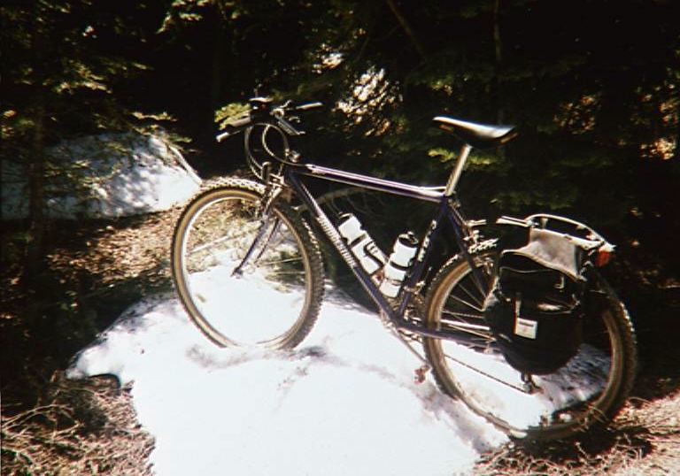
The dirt ended behind the Tahoe City golf course, and I hooked up with Highway 28 again and returned to the Tamarack Lodge, where I took an extremely muddy self-portrait. Unfortunately it doesn’t really capture how much of a mess I was, although you can sort of see how the down tube of the bike is completely covered with mud, and I’ve got it splattered all the way up to my face.

I can’t wait for the next ride.