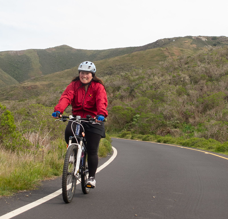
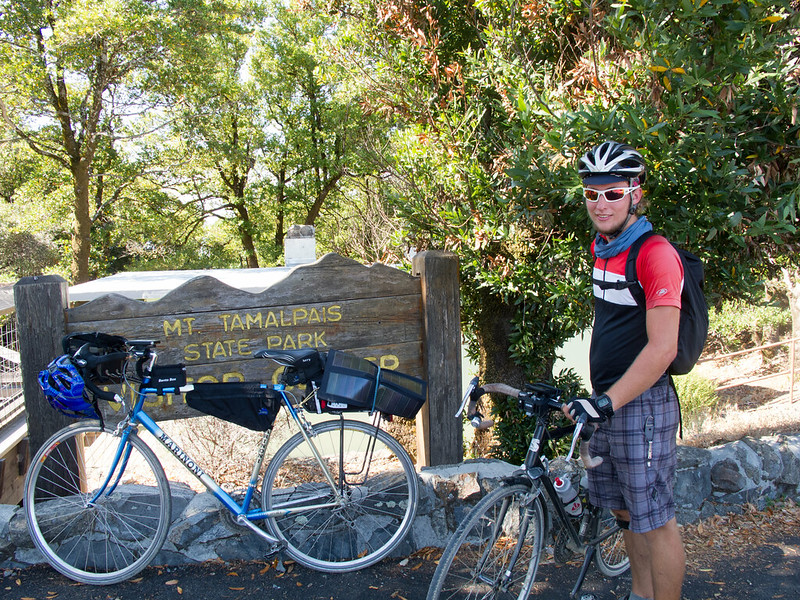
Mount Tamalpais
Mount Tamalpais is the prettiest of the three major mountains in the Bay Area, and the easiest ride. It has beautiful views of Muir Woods, San Francisco, the bay and the ocean. The Marin Headlands (intermediate ride) is a good start for “advanced beginners” who want to start beefier rides. Civilization level and traffic are mostly moderate.
If you prefer gravel, from Mill Valley you can take Old Railroad Grade up instead of Edgewood/Panoramic. Doable with road bike tires and more pleasant than the road. I definitely recommend the road on the way down, it’s fast and fun.
Route Maps
Beginner’s (27km)
Start: Daly City, End: San Francisco (Embarcadero)
Intermediate (49km)
Start: Daly City, End: San Francisco (Embarcadero)
Advanced (105km)
Start: Daly City, End: San Francisco (Embarcadero)
Gravel option (101km)
Start: Daly City, End: San Francisco (Embarcadero)


Road notes
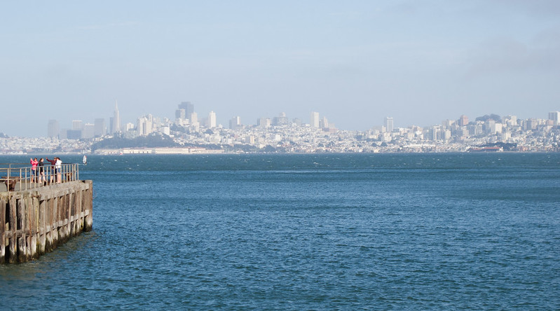
John Daly/Lake Merced/John Muir/Skyline Boulevard (all rides)
These roads are mostly wide and trafficky. John Daly goes downhill fast. John Muir is a quieter ride near Lake Merced (turn left just before you get to the lake). The left turns on John Muir and The Great Highway are a bit tricky (crossing two lanes of traffic to a left turn lane).
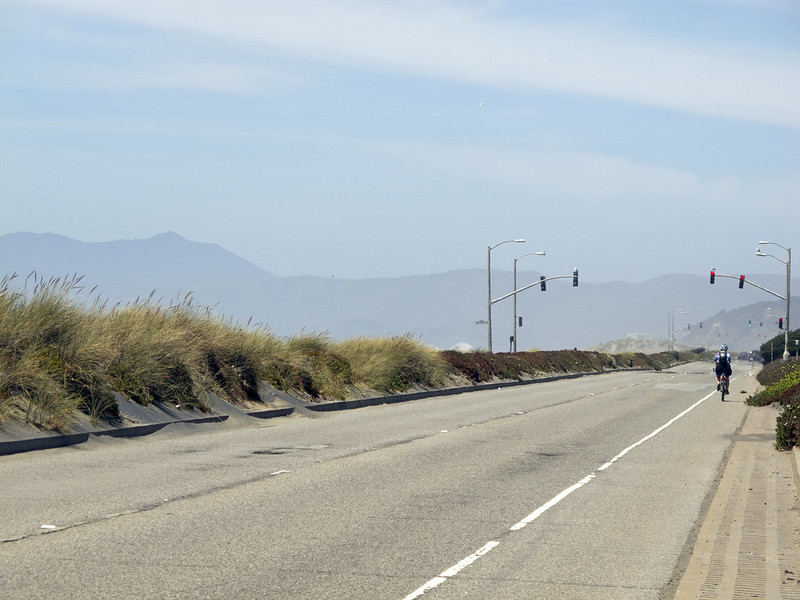
The Great Highway (all rides)
The Great Highway is a blast if the weather is right. There’s a short, somewhat steep hill, then a longer descent on the other side that brings you out to the ocean. After the first light it’s rail-straight and fast; there’s usually a nice tailwind on this section, and it’s pretty and often closed to motor traffic. There’s sometimes drifting sand on the road but usually not on the northbound side. There are traffic lights placed periodically but they’re only to let pedestrians cross to the beach so they’re usually ignorable. At the windmill, turn into Golden Gate Park.
Golden Gate Park (all rides)
Golden Gate Park is relatively quiet and pretty. All the roads are wide and well-paved. Most of them have rolling hills. The west side of the park often has a lot of cars parked on the road. Note: The left turn onto Crossover Drive may not be marked; it’s just before JFK Drive goes underneath Highway 1/19th Ave.
25th Avenue (all rides)
A fairly busy connector road through residential and commercial districts. 24th Ave. is also usable, marginally less busy.
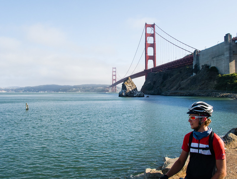
Lincoln Boulevard/McDowell Ave/Mason Street (all rides)
Lincoln is a wide road with moderate traffic through the Presidio. There’s a good climb up towards the bridge, then a descent back towards it; to get to the bridge, turn left just after going underneath the freeway. After the bridge, there’s a wide, fast descent, then a left turn on McDowell (still downhill) takes you underneath the freeway again; two right turns put you on Mason Street by Crissy Field. Mason often has a blasting tailwind through the Golden Gate, and it has a long straight section to try out your big ring.
Marina/Cervantes/Bay Street/Embarcadero (all rides)
After leaving the Presidio we end up on busy residential streets in the Marina District. They’re wide but there’s a lot of parking and cross traffic. There are options to go through Fort Mason, but the pedestrians, dogs, and Blazing Saddles riders are probably worse than the cars. Bay Street has a steep descent towards Columbus, then goes through a bit of Fisherman’s Wharf. Embarcadero has a decent bike lane and takes you to the Ferry Building, where you make a right to get to Embarcadero BART.
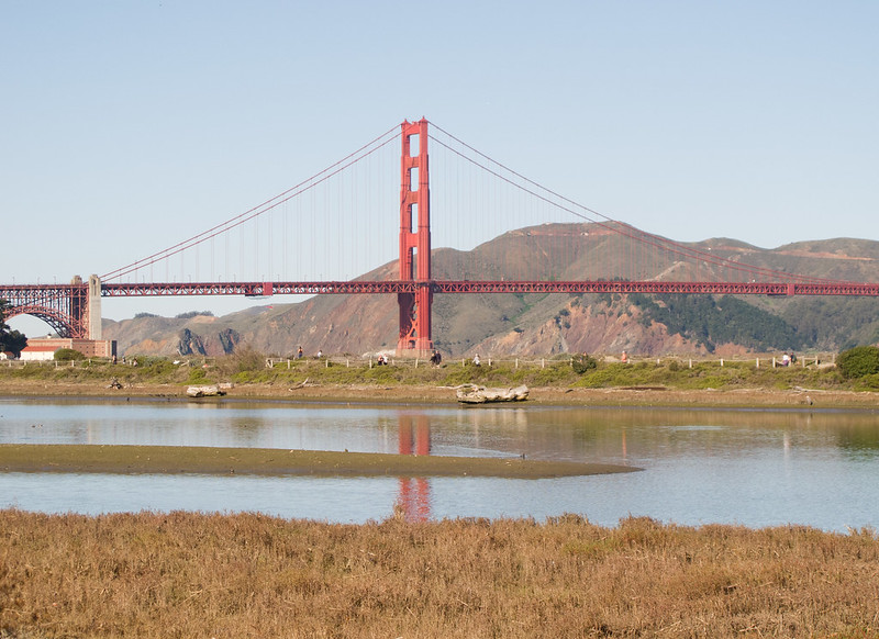
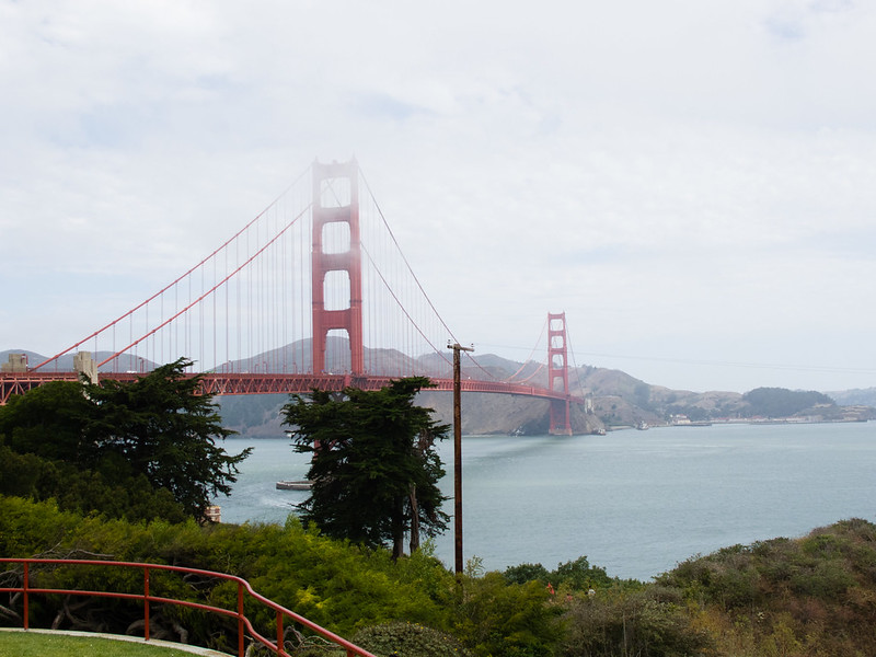
Golden Gate Bridge (intermediate/advanced rides)
I usually don’t enjoy riding on the bridge; it’s narrow, shared by two-way bike traffic (much of which is inexperienced tourists), it’s noisy, and there’s often strong winds and fog. That being said, it can be spectacular on a good day. Pay attention to what you’re doing; stop at one of the notches if you want to look at the view.
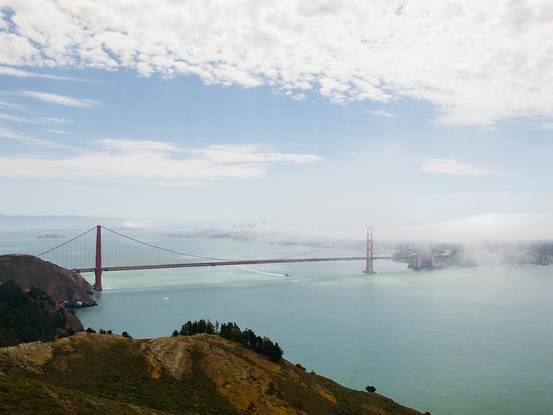
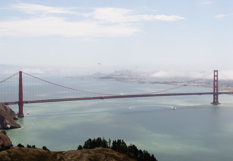
Conzelman Road (intermediate/advanced rides)
Conzelman is a GGNRA road; the speed limit is never above 25 and in fact is 15 for most of its length. It tends to have moderate traffic. Conzelman climbs steeply for a bit, then less steeply for a while; with awesome views of the bridge, the headlands, and San Fransisco all along its length. You might want to stop to rest at one of the “vista point” turnouts. At the very top of the hill there’s yet another great view. I usually wait at the peak for a significant gap between cars, because afterwards it becomes a narrow one-way street with a descent that is stunning in every sense of the word; do not let your speed get out of control. The really steep part ends after about 2 km and it flattens out, then climbs for a short stretch, then has a more controlled and fun descent on the way to the Point Bonita Lighthouse. Continue past the pedestrian footpath and stop at a lot overlooking Bird Island. It’s a great place for birdwatching if you’re into that, and there are sometimes whales offshore as well. If it’s not too chilly, this is a good place to stop for a snack.
Field/Simmon/Bunker Road (intermediate/advanced rides)
Field/Simmon/Bunker Road is fairly wide and starts with a nice tailwind-aided descent through the rolling hills of the headlands. After about 2 km it starts to climb until it enters a tunnel between West and East Fort Baker. The tunnel is sloped downwards and has a tailwind in this direction, but it’s only one lane (for both directions), so be alert. Wait for traffic to clear and get a good head of steam; it’s slightly downhill, with a tailwind. Fun! Try to stay in the middle of the tunnel; the bike lane is usually not usable due to debris and sand.
Sausalito Lateral/Bridgeway (advanced ride)
This is a wide, busy road into and through Sausalito. The descent into town is twisty and fairly narrow; you probably should take the lane. Once in town, there are usually large crowds of pedestrians and slow-moving cars; keep an eye out. After leaving downtown it’s more reasonable. Where the road goes onto the freeway, get onto the bike path on your right.
Mill Valley-Sausalito bike path (advanced ride)
On weekends the traffic on this path can be out of control; watch out for dogs and people wobbling all over the place. Other than that it’s reasonably pleasant. Don’t go all the way to the end; get on Sycamore at the circle by the water fountain and ball fields.
Sycamore/Monteford/Molino/Edgewood/Sequoia Valley (advanced ride)
This sequence of roads gets us from the bike path, through Mill Valley and up to Panoramic Highway. We’re taking a slightly long way around, because Highway 1 between 101 and Mt. Tam is very narrow and has a steady stream of people burning irreplaceable fossil fuels and polluting the air to get to places where they can stroll on concrete paths beneath redwoods (which elsewhere are being clear-cut to make room for more strip malls and tract housing), an activity they refer to as “enjoying the outdoors”, and God forbid they be delayed for a few seconds by someone who is not in an air-conditioned cage.
Anyway, there are a couple of quick turns in town, then the route starts to climb the hill, on roads with moderate traffic. There are a few steep sections.
Panoramic Highway (advanced ride)
Panoramic is aptly named; it has beautiful views of Muir Woods and the coastline. It’s fairly wide and has moderate traffic. Mountain Home Inn is a nice stop for a beverage or lunch. After Mountain Home the climb begins in earnest; it’s a bit varied, with steep sections combined with flats, downhills, and grinding climbs.
Pan Toll Road/Ridgecrest Boulevard (advanced ride)
The climb to the peak is similar to Panoramic, but steeper and less varied in grade. It goes past the Mountain Theater and the radio telescope on the west peak. There’s a saddle between the west and east peaks; the road goes down a non-trivial descent, then you have to climb back up to the parking lot at the end of the road, where there’s a snack bar, water and restrooms, and a museum about the tourist railroad that used to exist on the mountain (now the Old Railroad Grade fire road). To get to the actual peak you have to climb the foot path to the fire lookout.
Old Railroad Grade (gravel option)
The path that the tourist railroad up Mount Tamalpais used is still available for biking. It’s very wide and evenly graded, except for a few dips at creek crossings which formerly had railroad trestles. It’s all rideable on road bike, and more pleasant than the climb with traffic on Panoramic. The West Point Inn is a nice spot, accessible only via trail, that hosts a monthly pancake breakfast. The ride from West Point up to the peak is a notch harder than the rest of the road (slightly steeper and slightly more gravelly) but still totally doable.