Day 4: Waterton to East Glacier
We were supposed to get up early for day 4—this would be our longest riding day and included quite a bit of climbing. The tone for my day was set when I discovered I’d left the phone off the hook the night before, thereby missing my official wake-up call and Nola and Julie’s follow-up attempts. I would find myself a half-hour behind all day.
Yesterday’s winds had died away, leaving placid waters and a bright, clear day. I took the opportunity to shoot a Waterton panorama and some other shots–the still, clear lakes reflected the peaks beautifully. As usual, I was the last one on the road, and started out slowly, stopping for more pictures along Middle and Lower Waterton Lake.

I caught up with Mark and Suzanne, and Mark and I rode together for a while alongside Sofa Mountain. The weather today was much better, affording us opportunities to stop and take pictures of Sofa Mountain (including the charred husks of trees burnt in a 1998 fire) and just generally to enjoy the scenery along the way. But “Paradise by the Dashboard Light,” which was still stuck in my head, is not the soundtrack for a slow grind, so I picked it up a notch, and Mark went with me.

Remember that 73kph descent from yesterday? Today it was a 7.3kph climb. Midway up we encountered Nancy at her more stately pace, and Mark called “on your left!” while I called “on your right!”. (Mark categorized us as the “Tour de Pants”). We regrouped just short of the border checkpoint, Nancy following us closely, and Julie and Suzanne plodding up not long after. (Julie wasn’t even breathing hard–we suspect her of holding back so as not to embarrass us).

After we crossed the border, I settled into my normal “century pace.” When I’m riding a century, I usually don’t want to hammer, for fear of bonking; on the other hand, I want to keep the pace up so I’m not out there for 10 hours. Today we were looking at 130 kilometers; I was through lollygagging. I did stop back at Two Sisters for one of the enormous Rice Krispie Treats, which was good except that it’s rather difficult to eat a Rice Krispie Treat that’s 3 inches tall.
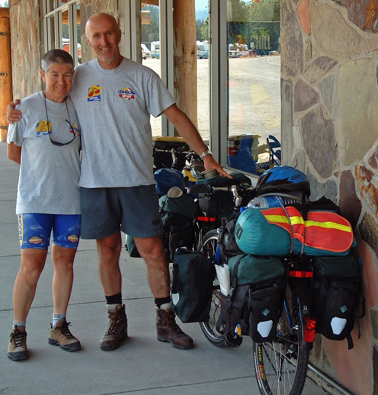
On my way back to Saint Mary, my annoying rack squeak manifested itself again. I stopped in town to look for a hex-head bolt–the small Allen bolt was impossible to tighten with sufficient torque. I didn’t find a bolt, but Nola showed up with the van and managed to dig one out of the parts bag. After securing the rack, I got to talk for a while to a wonderful retired couple from Italy who were just starting their unsupported three-month tour to Florida. I can only hope that I’m still capable of that kind of adventure when I’m a certified senior citizen.
Saint Mary is where the Going To The Sun Road meets Highway 89, so once I was south of Saint Mary I was seeing new terrain for the first time today. There was a 10 kilometer climb up the Hudson Bay Divide, followed by a series of rolling hills; not the best terrain for a long-mileage day. Paul was well off the front, and the rest of the crew had stopped in Saint Mary for lunch and pie, so I was pretty much alone for the rest of the trip. I saw the van once more and picked up some water and gorp, but other than that I was on my own, except for the cattle. There was quite a bit of that along Highway 89, including a family of four that stood in the middle of the four-lane highway, directing traffic. Once, a steer startled at my approach and ran in front of me alongside the road for almost half a kilometer—he thought I was trying to herd him but he couldn’t find a herd to join.
As I rode further into the Blackfeet Indian Reservation, the terrain changed from granite peaks with alpine foliage to rolling hills with chaparral. It looked vaguely Spanish for some reason. I was beginning to get a little worn out. My first external sign of fatigue is usually when I feel that stopping for pictures would take too much energy. So I don’t have a lot of pictures of the Blackfeet Indian Reservation.
The general store at Kiowa Junction provided the last services before East Glacier. I was pretty beat at this point–I’d already done well over 100 kilometers–and there was still a significant climb ahead of me. I picked up some Oreos and sat out on the picnic tables marshaling my energies. Aggressive yellowjackets (“get the hell off my Oreos!”) encouraged me to get rolling quickly. A right turn onto Chief Looking Glass Road brought me to the final climb of the day.
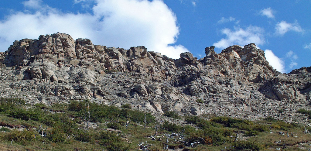
Looking Glass was an interesting climb. Most of the cliff faces we’d seen so far had been obviously glacial, but the striations in the rock along Looking Glass were clearly tectonic in nature. It made for different coloring and a generally distinct feel to the road. Along the way I was “warned” by some locals that there was a bear in the woods somewhere. I didn’t point out that I’d consider a bear encounter the highlight of the day–in any case, I didn’t wind up seeing him.
With leaden legs and empty lungs–the altitude was definitely affecting me–I crested the hill and began the descent down to East Glacier, passing Lower Two Medicine Lake on the way. I didn’t know it at the time, but that’s where we would be hiking the next day. In any case, I was too tired to pay much attention to it.
Finally, I reached the town of East Glacier. This was the first place we’d stayed where there was any establishment other than the lodge where we were staying, but getting to the town would have involved walking across the street, which was too much for me that night. I crawled upstairs, let the shower run over me for a while, and managed to work up enough energy to come back down for dinner. (Late, of course).
I had a plate of fettuccine alfredo. Well, “plate” doesn’t really do it justice. It was more like a salad bowl, heavy and full. Several members of the group were dubious that I’d finish it, but I grew up in an Italian household, and you didn’t walk away from a plate of pasta. It took quite a while and I had no room for dessert, but let the record show that I polished it off. (No one took me up on my $1 bet).
At dinner I caught up on the stories of the day. Paul had felt strong all day and got in about half an hour before me. Nancy methodically ground out the miles and came in about an hour after me. Mark had the roughest day of all, winding up with three flat tires, including one before he got to St. Mary’s, where he waited on the road for an hour while the rest of the group had pie. His third flat, on the climb up Looking Glass, was enough to finish him off, and he sagged. Suzanne soldiered through about 100km, but sagged a little ways before Mark did. Everyone was tired, but tomorrow was a rest day. We retired early and slept the sleep of the just.
| Day 4 | Cumulative | |
|---|---|---|
| Average speed: | 21.2 kph | 22.3 kph |
| Distance: | 123.9 km | 376.9 km |
| Climb | 1548 m | 4092 m |